EU's Copernicus Satellite Image Delay: Implications of US Influence in Iran Conflict
The European Union's recent decision to delay the release of satellite images of the Iran War region raises significant concerns about transparency and the implications of geopolitical tensions on public access to information.
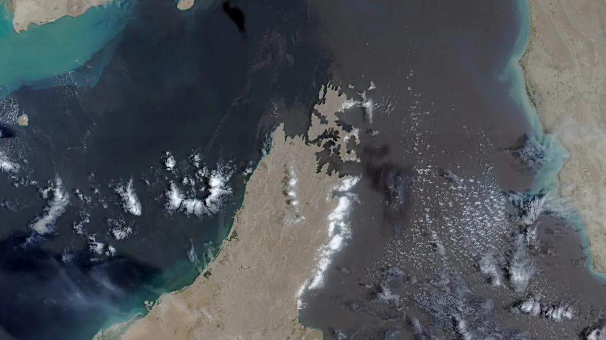
The delicate balance of transparency and security in conflict zones has once again come under scrutiny as the European Union (EU) recently agreed to a request from the United States to delay the release of satellite images from its Copernicus program. This decision, which imposes a 24-hour hold on images capturing critical shipping lanes in the Strait of Hormuz, comes at a time when tensions between the US and Iran have escalated following renewed military actions by the Trump administration. As the conflict intensifies, the implications of this delay reach far beyond mere logistics; they touch on issues of freedom of information, military strategy, and the role of technology in modern warfare.
The Copernicus Earth observation program, which aims to provide free and open access to satellite imagery for various applications including environmental monitoring and disaster management, now finds itself at a crossroads. The move to restrict access to satellite data highlights the growing influence of national security concerns over the principles of transparency and public oversight in military engagements.
Understanding the Context: The Iran Conflict and Satellite Surveillance
The backdrop of the EU's decision is the ongoing conflict that erupted when the US and Israel initiated military operations against Iran on February 28, 2026. The war has resulted in significant casualties and geopolitical ramifications, particularly in the Gulf region. The Strait of Hormuz, a crucial maritime passage for global oil shipments, has become a focal point for military and intelligence operations, making satellite surveillance an essential tool for both sides.
The Role of Satellite Imagery in Modern Warfare
Satellite imagery has transformed the landscape of military intelligence. The ability to monitor troop movements, assess damage from air strikes, and track logistical operations provides critical insights that can influence the course of a conflict. For instance, US military and intelligence agencies have heavily relied on their own satellite constellations to observe Iranian activities throughout the war. In contrast, Iran has engaged Chinese satellite resources to counteract US advantages and monitor military assets.
The Copernicus Program: A Pillar of Transparency
The EU's Copernicus program has stood out as a beacon of transparency in global affairs. By providing access to high-resolution satellite imagery, it has empowered journalists, researchers, and organizations to conduct independent assessments of conflicts. Investigative journalism groups like Bellingcat have utilized Copernicus images to analyze damage in war-torn areas, shedding light on the often opaque realities of warfare.
- 24-hour delay: The EU's new policy puts a temporary hold on images critical to understanding military actions.
- Increased reliance on alternatives: With US satellite firms restricting imagery, Copernicus becomes a vital resource.
- Impact on journalism: Major news outlets are using Copernicus data to report on conflicts, enhancing public awareness.
The Shift in US-EU Relations and Its Impact on Transparency
This latest decision by the EU signals a shift in how international alliances may prioritize security over transparency. The US government initially requested the delay on May 26, 2026, during a fragile ceasefire period, marking a significant moment in the US's approach to foreign policy and military strategy. The request appears to be part of a broader strategy by the Trump administration to restrict access to information that could be used to benefit adversaries or undermine military operations.
Challenges for Journalists and Researchers
The 24-hour delay, while less stringent than the restrictions imposed by US satellite firms, presents challenges for journalists and researchers who rely on timely information to report on the conflict. The Pentagon's reluctance to share information about military casualties or damage exacerbates this issue. As the situation develops, the need for timely and accurate information has never been more pressing. The delay creates additional friction that could hinder the ability of journalists to provide real-time analysis of developments on the ground.
Geopolitical Consequences and the Global Energy Market
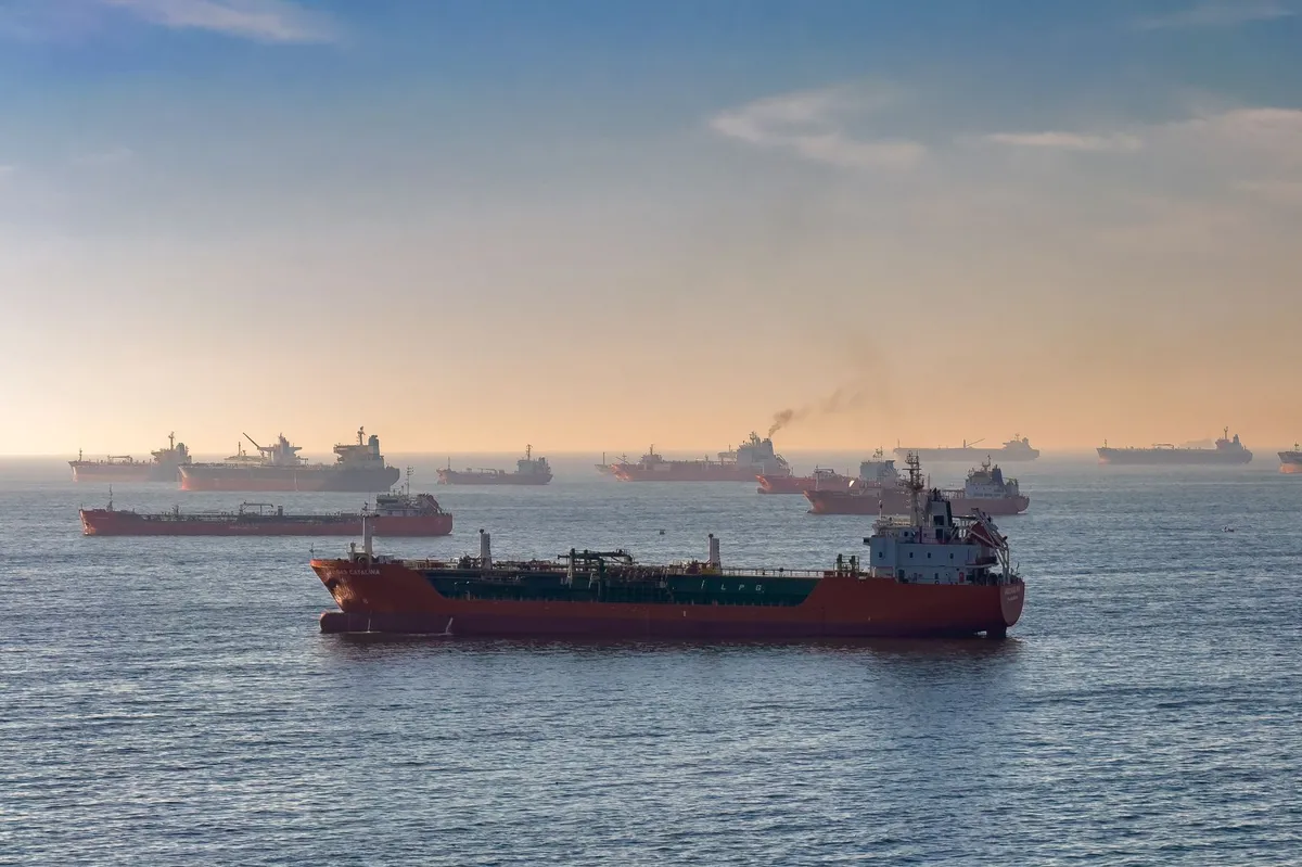
The ramifications of the Iran conflict extend beyond the battlefield, affecting global energy markets and international relations. The Strait of Hormuz is a critical passage for oil shipments, with a significant percentage of the world's oil supply traversing this narrow waterway. Disruptions in this region have already triggered global energy shocks, pushing oil prices higher and creating uncertainty in international markets.
As Secretary of Defense Pete Hegseth has noted, the ongoing conflict has already cost the United States over $37 billion, with additional funding requests indicating that the financial toll is expected to increase. The combination of military expenditures and energy market volatility poses a significant challenge for policymakers, who must navigate the complexities of military engagement while ensuring the stability of energy supplies.
Key Takeaways
- The EU's delay of satellite imagery highlights a shift towards prioritizing security over transparency in military conflicts.
- Copernicus imagery remains a vital resource for independent analysis despite increased restrictions from US satellite firms.
- The Iran conflict has significant implications for global energy markets and international relations, necessitating careful monitoring and reporting.
Frequently Asked Questions
What is the Copernicus satellite program?
The Copernicus program is a European Union initiative that provides free access to satellite imagery and data for various applications, including environmental monitoring, disaster response, and conflict analysis. Its goal is to enhance public awareness and facilitate informed decision-making by making satellite data available to the public.
Why did the US request a delay in satellite imagery release?
The US requested the delay in satellite imagery to protect national security interests amid escalating tensions with Iran. The request came during a period of renewed military operations and was aimed at limiting access to information that could potentially benefit adversarial forces.
How does this affect journalists and researchers?
The delay in satellite imagery release complicates the work of journalists and researchers who rely on timely data to report on conflicts. While a 24-hour delay is less onerous than more stringent restrictions, it still creates obstacles to providing real-time coverage and may hinder public understanding of military engagements.
What are the broader implications of the Iran conflict?
The Iran conflict has far-reaching implications, including disruptions to global energy markets and rising military expenditures. As tensions escalate, the potential for further destabilization in the region increases, affecting oil prices and prompting concerns over international security and economic stability.
Comments
Protecting Your Business from Cl0p Ransomware Attacks: A Guide
The Cl0p ransomware group has recently targeted vulnerabilities in widely-used software, posing a significant threat to businesses. In this article, we delve into the implications of these vulnerabilities and how organizations can bolster their cybersecurity defenses.

Related articles


Popular in Cybersecurity
- Federal Mandate for Autonomous Vehicles: A Call for Safety Compliance
- EU Mandates Google to Share Data and Open AI on Android: What It Means
- GitHub Revamps Bug Bounty Program: Implications for Developers and Security
- Australian Government Disables Thousands of Functional Broadband Routers: A Wasteful Decision
- Exploiting Redis: Understanding Zero-Day Vulnerabilities and Their Mitigation