Revolutionizing Wildfire Detection: Google-Backed FireSat Satellites Launch
The launch of FireSat satellites marks a pivotal advancement in wildfire detection technology, promising to mitigate the devastating impacts of wildfires across the globe. This article explores the implications of this innovation amid escalating wildfire crises in North America.
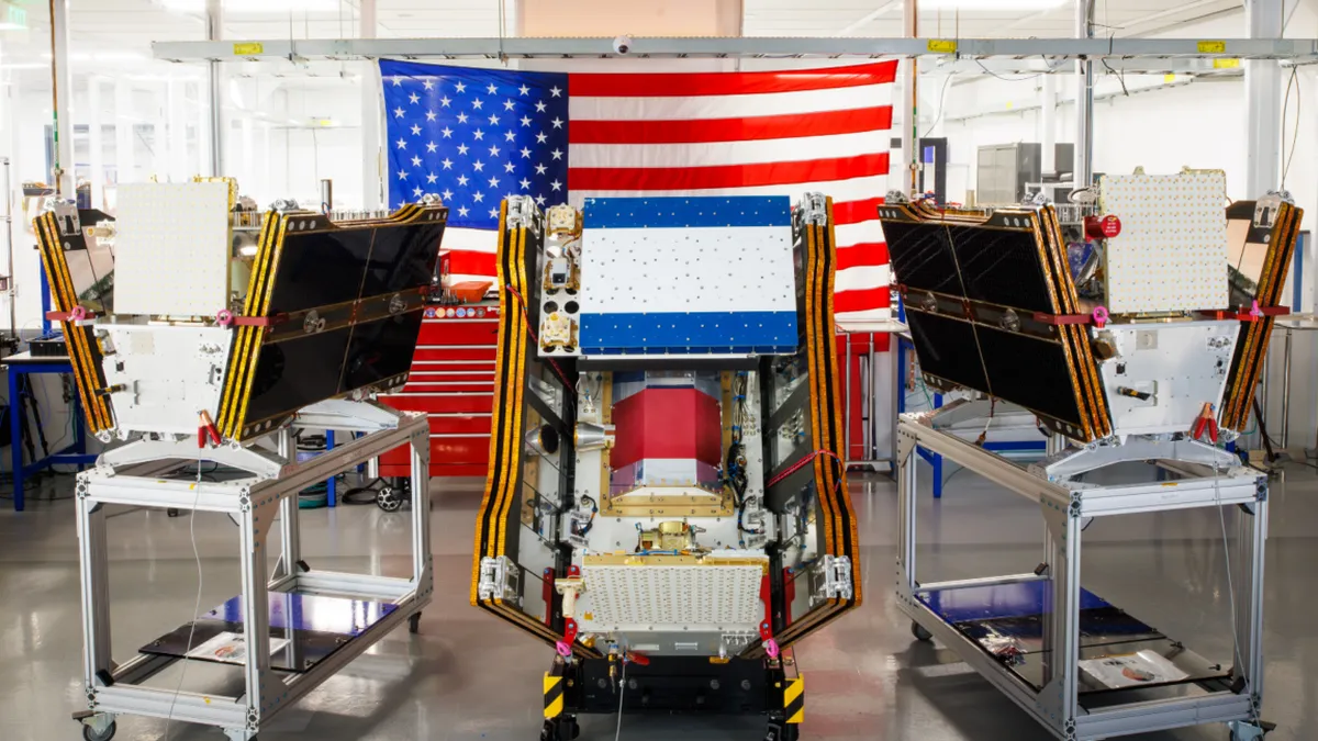
As smoke from raging wildfires blankets vast areas of Canada and the United States, the launch of the FireSat satellite constellation signals a transformative leap in wildfire detection capabilities. Developed with the support of Google and other major investors, these satellites are engineered to identify wildfires before they escalate, providing a much-needed tool in the fight against increasingly frequent and devastating blazes.
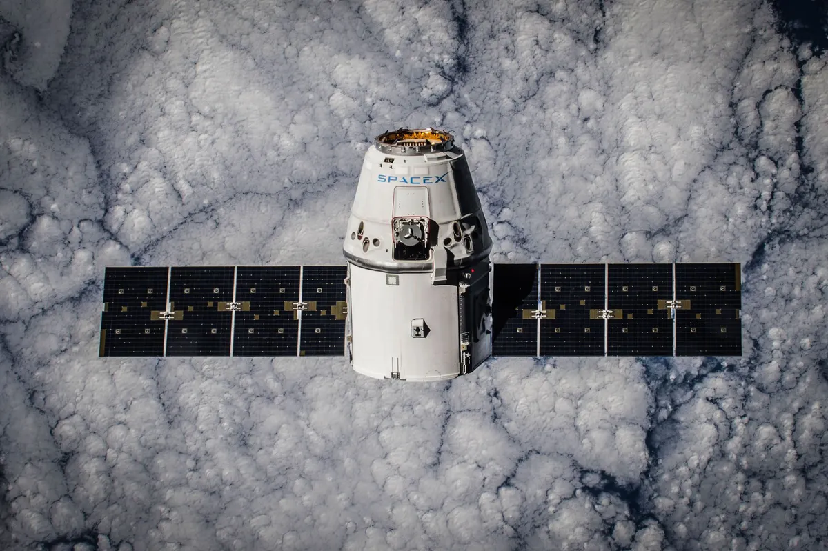
Launched on July 7, 2026, aboard a SpaceX Falcon 9 rocket from Vandenberg Space Force Base in California, the initial three satellites in the FireSat constellation are now in orbit and preparing to begin operations after a brief testing phase. The potential of this technology could not come at a more critical time, as wildfires continue to wreak havoc, forcing evacuations and causing widespread air quality issues across North America.
Understanding FireSat: The Technology and Its Capabilities
The FireSat constellation represents the first of its kind, specifically designed to detect wildfires with unparalleled precision. Unlike traditional satellite systems that often overlook smaller blazes, FireSat utilizes advanced multispectral imaging technology capable of penetrating smoke and cloud cover. This allows it to identify fires as small as five meters by five meters—about the size of a typical family car.
Technical Specifications and Launch Details
Each satellite in the FireSat program is built by Muon Space, a California-based manufacturer with a focus on innovative satellite technology. Backed by over $15 million from Google and a substantial $26 million from the Bezos Earth Fund, the project has garnered significant financial support aimed at revolutionizing wildfire detection. The satellites will provide data to fire agencies in California, Colorado, Australia, and Portugal, marking the beginning of their operational phase.
Operational Timeline and Future Goals
After a three-month testing period, the FireSat satellites will start delivering actionable data to fire management agencies, enabling them to monitor fire-prone regions at least twice a day. By 2029, the program aims to achieve a global coverage frequency of every hour, with plans to scale up to a full constellation of over 50 satellites by the early 2030s. This rapid advancement promises to provide critical intelligence that could lead to the early detection of wildfires, potentially saving billions in damages and conserving valuable ecosystems.
The Environmental Impact of Wildfires
The implications of improved wildfire detection extend beyond mere economic benefits. Wildfires contribute significantly to carbon emissions, with FireSat's developers estimating that timely detection could prevent nearly 22 million tons of carbon dioxide from entering the atmosphere. With the potential to protect 3,500 homes and nearly 1.3 million acres of land, the FireSat program is positioned as a crucial element in mitigating the broader impacts of climate change.
The Role of AI in Wildfire Management
Google Research is set to play a pivotal role in enhancing the effectiveness of FireSat by leveraging AI models to analyze operational data alongside historical imagery. This integration aims to refine the identification of small fires and improve predictive modeling, ultimately leading to more effective wildfire management strategies. As Google aptly stated, this initiative exemplifies the practical application of AI for climate resilience.
The Broader Context of Wildfires and Climate Change
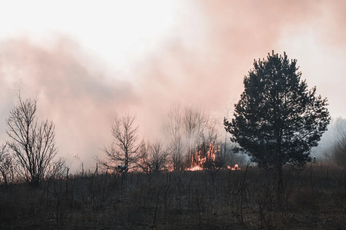
While FireSat represents a significant advancement in wildfire detection, it is important to recognize that technology alone cannot solve the escalating wildfire crisis. Climate change continues to exacerbate the conditions that lead to devastating wildfires, particularly in regions like Canada's boreal forests. This summer has witnessed some of the most intense wildfires in recent history, resulting in a toxic haze that has affected air quality for over 100 million people across North America.
As the climate warms, the frequency and intensity of wildfires are expected to increase, challenging traditional fire suppression methods. As Werner Kurz, a retired senior research scientist at Natural Resources Canada, indicated, the strategies of the past are becoming increasingly inadequate. The reality of climate change means that fire agencies must adapt and adopt new technologies and strategies, such as those offered by FireSat, to combat these increasingly severe threats.
The Challenges Ahead for Fire Management Agencies
Despite the promise of new technologies, fire agencies face considerable challenges in managing resources effectively. The Canadian government recently leased additional aerial firefighting aircraft to bolster the response to ongoing wildfires, but the need for such resources is ever-growing. In 2023, Canada experienced nearly 3,600 wildfires that consumed over 6.6 million acres, highlighting the urgent need for improved detection and response capabilities.

Key Takeaways
- FireSat satellites are the first constellation specifically designed for wildfire detection.
- Equipped with multispectral imaging, these satellites can detect fires as small as five meters.
- Google and the Bezos Earth Fund have invested over $41 million in the project.
- With improved detection, FireSat could help save over $1 billion in wildfire damages by 2029.
- AI models will enhance the precision of wildfire predictions and management strategies.
Frequently Asked Questions
What are the main benefits of the FireSat satellites?
The FireSat satellites offer significant advantages in wildfire detection, particularly their ability to identify small fires that traditional systems often miss. This early detection can lead to quicker response times, potentially saving lives, property, and ecosystems from devastating wildfires. Additionally, the integration of AI technology will enhance predictive capabilities, allowing for more effective resource allocation and fire management strategies.
How do FireSat satellites compare to existing wildfire detection methods?
Existing wildfire detection methods often rely on thermal imaging and visual assessments from satellites that may not capture smaller fires or those obscured by smoke. FireSat's advanced multispectral imaging technology allows it to penetrate smoke and clouds, providing more accurate and timely data. This capability is crucial for addressing the challenges posed by increasingly intense wildfires driven by climate change.
What is the role of funding in the FireSat program?
Funding plays a critical role in the development and deployment of the FireSat satellites. With over $41 million raised from investors like Google and the Bezos Earth Fund, these resources are essential for building and launching the satellites, as well as for ongoing research and development. This financial backing supports the advancement of wildfire detection technology, which is increasingly vital in the context of climate change and its impact on wildfire frequency and intensity.
How can fire agencies utilize FireSat data effectively?
Fire agencies can utilize FireSat data by integrating it into their existing fire management systems. The timely imagery provided by FireSat will help agencies monitor fire-prone areas more effectively and respond to new fires before they escalate. By collaborating with Google Research and employing AI models, agencies can further enhance their predictive capabilities, optimize resource deployment, and improve overall wildfire management strategies.
Comments
Taco Bell's Iceberg Lettuce Linked to Cyclosporiasis Outbreak Across 5 States
A recent outbreak of cyclosporiasis linked to Taco Bell's shredded iceberg lettuce has affected 34 states, prompting federal health officials to issue warnings. The implicated lettuce, sourced from a single supplier in Mexico, has raised serious concerns about food safety in fast-food chains.
Related articles



Popular in Cybersecurity
- Federal Mandate for Autonomous Vehicles: A Call for Safety Compliance
- EU Mandates Google to Share Data and Open AI on Android: What It Means
- GitHub Revamps Bug Bounty Program: Implications for Developers and Security
- Australian Government Disables Thousands of Functional Broadband Routers: A Wasteful Decision
- Exploiting Redis: Understanding Zero-Day Vulnerabilities and Their Mitigation